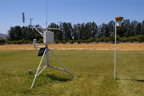
Ventura County UCCE staff research associate, Maren Mochizuki explains how weather data is collected and shared.
The California State Irrigation Management Information System (CIMIS) is a program of the California State Department of Water Resources Office of Water Use Efficiency.
CIMIS consists of a network of more than 120 weather stations throughout California that measure parameters such as air and soil temperature, precipitation or rainfall, wind speed, relative humidity, amount of solar radiation, and much more. This data is recorded every minute at most stations; data from some stations are available from as far back as 1982!
Growers use this data to aid in irrigation planning and scheduling for their crops but data from any of the stations is available free to the public the day after the data has been recorded.
To find stations nearest to you and to view a sample report with data from the last seven days, please visit: http://wwwcimis.water.ca.gov/cimis/frontSampDailyReport.do

Photos of CIMIS station