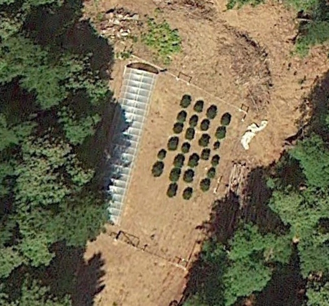
A recent study led by UC Cooperative Extension specialist Van Butsic used high resolution satellite imagery to conduct a systematic survey of cannabis production and to explore its potential ecological consequences.
Published this spring in Environmental Research Letters, the study focused on the “emerald-triangle” in northern California's Humboldt, Mendocino, and Trinity counties, which many believe is the top cannabis-producing region in the United States.
The UC Berkeley-based Butsic and his co-author Jacob Brenner used Google Earth imagery to locate and map grow sites (both greenhouses and outdoor plots) in 60 watersheds. Most cannabis grow sites are very small, and have gone undetected when researchers used automated remote sensing techniques, which are commonly used to detect larger changes such as deforestation.
“We chose to use fine-grained imagery available in Google Earth and to systematically digitize grows by hand, identifying individual plants. Most plants stand out as neat, clear, little circles,” said Brenner, who is on the faculty of the Department of Environmental Studies and Science at Ithaca College. “The method was laborious — it took over 700 hours — but it proved to be highly accurate.”
Butsic and Brenner paired their image analysis with data on the spatial characteristics of the sites (slope, distance to rivers, distance to roads) and information on steelhead trout and Chinook salmon, both of which are listed as threatened species under the federal Endangered Species Act. These and other species are vulnerable to the low water flows, soil erosion, and chemical contamination that can result from nearby agriculture.
Results of the study show 4,428 grow sites, most of which were located on steep slopes far from developed roads. Because these sites will potentially use significant amounts of water and are near the habitat for threatened species, Butsic and Brenner conclude that there is a high risk of negative ecological consequences.
“The overall footprint of the grows is actually quite small [~2 square kiliometers], and the water use is only equivalent to about 100 acres of almonds,” says Butsic, who is in the Department of Environmental Science, Policy, and Management at Berkeley. According to Butsic, California currently has more than one million irrigated acres of almonds.
He stresses that the issue lies in the placement of the sites: “Close to streams, far from roads, and on steep slopes — cannabis may be a case of the right plant being in the wrong place.”
Last year, California legislature passed laws designed to regulate medical marijuana production, and state voters will weigh in on whether to legalize recreational marijuana this coming fall. Given these changes as well as the profitability of cannabis production, Butsic expects that marijuana cultivation will expand into other sites with suitable growing conditions throughout the region. He and Brenner assert that ecological monitoring of these hotspots should be a top priority.
Bills recently signed into law by Governor Jerry Brown have made some advances in this direction — requiring municipalities to develop land use ordinances for cannabis production, forcing growers to obtain permits for water diversions, and requiring a system to track cannabis from when it is first planted until it reaches consumers.
But the researchers say that regulation will likely be a constant challenge because it will rely on monitoring procedures that are just now emerging, as well as voluntary registration from producers and budget allocation from the state for oversight and enforcement.
“Some of the same fundamental challenges that face researchers face regulators as well, primarily that cannabis agriculture remains a semi-clandestine activity,” says Brenner. “It has a legacy of lurking in the shadows. We just don't know — and can't know — where every grow exists or whether every grower is complying with new regulations.”