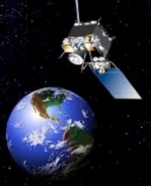
Sustainable water management is one of the most challenging issues of our time, especially in the arid western U.S. Adequate water supplies are crucial to maintaining the health of communities, rivers, and wildlife, and nothing is more important to agriculture's ability to produce food for the world's growing population. Maximizing the benefits of our water supplies requires careful measurement of their availability and use. For irrigated agriculture, satellite-based estimates of evapotranspiration (ET) provide a measure of the water used to grow food — the biggest share of water consumption in most arid environments around the world. However, access to this data has been limited and expensive, keeping it out of the hands of most water users and decision-makers.
OpenET provides open, easily accessible satellite-based ET data for improved water management. The OpenET collaborative includes leading national and international experts in remote sensing of ET, cloud computing, and water policy, partnered with nationally recognized web development teams and leaders in the western agriculture and water management communities.
This data site can focus in on a field or orchard using Google Earth and provide a monthly and yearly water use for that orchard. It's not the potential water use – the amount of water that could be used in the field driven by weather elements – but the actual water use, the consumptive use. If the field is under irrigated, it would show how little water is being lost there. If the field is over irrigated, it will show the potential ET.
At the moment, the data is not for daily use, although that is forecast to occur later in the year. It also has somewhat clunky navigation, but with patience, it's possible to get around to finding an individual field. It's a work in progress, but it could be a great tool soon.
It's free and you can check it out at: https://openetdata.org/about/
