Forecasting Crop Water Use?
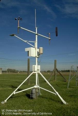
The California Irrigation Management Information System (CIMIS) is a program unit in the Water Use and Efficiency Branch, Division of Regional Assistance, California Department of Water Resources (DWR) that manages a network of over 145 automated weather stations in California. CIMIS was developed in 1982 by DWR and the University of California, Davis (UC Davis). It was designed to assist irrigators in managing their water resources more efficiently. Efficient use of water resources benefits Californians by saving water, energy, and money. https://cimis.water.ca.gov/
CIMIS reflects the energy that has arrived to drive water use by crops. It is the past. Now the National Weather Service has devised a way of forecasting water use, so that growers can be better prepared for irrigation. The question is how well does this new system work. Well, here are the results or a study that should lend confidence in the predictive value of the system.
COMPARISON BETWEEN FORECASTS OF REFERENCE EVAPOTRANSPIRATION and ETo VALUES CALCULATED USING DATA FROM DIFFERENT CLIMATIC CONDITIONS.
G. Ben Hamouda, F. Ventura, D. Zaccaria, R.L. Snyder, K.M. Bali.
Evapotranspiration is the transfer of water from the earth's surface to the atmosphere. It comprises the sum of water losses to atmosphere due to the processes of evaporation of moisture from soil, water bodies and wet plant canopies, and the transpiration of water from plants. Forecasts of this crucial component of the hydrologic cycle can be very valuable for growers, farm managers, irrigation practitioners, water resource planners and managers, and reservoir operators for their planning, allocation, delivery and scheduling decisions, as well as to hydrologic scientists for research purposes. Verifying the reliability of models' forecasts is among the critical tasks for development and performance evaluation of physical models. In fact, the verification allows understanding the models' behavior under different climatic conditions, and evaluating their applicability and dependability.
The US National Weather Service (NWS) has released a product that provides forecasts of reference evapotranspiration (FRET) at 2.5-km grid resolution for the entire continental US. In this study, a comparison is made between ETo estimates from FRET and ETo values calculated by the California Irrigation Management Information System (CIMIS) for 68 days during summer 2019. Both the FRET forecasts and ETo values were obtained from NWS and CIMIS, respectively, on the basis of 15 CIMIS locations that are representative of different climatic conditions in California. In addition, air temperature, dew point temperature, relative humidity, wind speed, and vapor pressure deficit (VPD) data were also collected/calculated from the NWS and CIMIS websites to analyze the sensitivity of FRET forecasts to predictions of these parameters. All FRET forecasts were performed with timescales of 1, 3, 5 and 7 days. Statistical indices were calculated to assess the dependability of FRET values. They showed a good correlation of the FRET model outputs with CIMIS ETo data, with some differences depending on the climatic characteristics of selected weather stations' locations, suggesting that FRET data could be valuable for anticipating near-future water demand and improve irrigation management in California.
Look for a more detailed description of this study in a forthcoming edition of the Journal of Irrigation and Drainage Engineering – ‘Evaluation of Forecast Reference Evapotranspiration (FRET) for Different Microclimates Regions in California to Enable Prospective Irrigation Scheduling' - https://ascelibrary.org/journal/jidedh
FRET is available at:
https://www.weather.gov/abr/etforecasts
And more:
https://www.weather.gov/cae/fretinfo.html
https://www.weather.gov/abr/etforecasts
https://ui.adsabs.harvard.edu/abs/2016AGUFM.H21D1430O/abstract
https://www.weather.gov/ict/Evapotranspiration


