Posts Tagged: usda
USDA Climate Smart Resources for Agriculture
Are you interested in climate-smart solutions for your agricultural or forestry operation? USDA offers voluntary programs and services to help you build soil health, sequester carbon, reduce greenhouse gas emissions, enhance productivity and commodity marketability, and mitigate the impacts of climate change while building resilience to strengthen your operation.
Check it out
USDA Investigating Packages of Mysterious Seeds
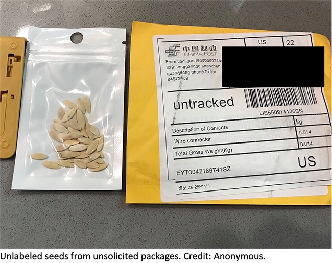
Have you had unexpected seeds show up in the mail? Unknown seeds could be invasive plants, contain invasive insects, or have plant disease causing agents. Here's what the United States Department of Agriculture Animal Plant and Health Inspection Service (USDA APHIS) has to say about it.
USDA Investigates Packages of Unsolicited Seeds
USDA is aware that people across the country have received suspicious, unsolicited packages of seed that appear to be coming from China. USDA's Animal and Plant Health Inspection Service (APHIS) is working closely with the Department of Homeland Security's Customs and Border Protection, other federal agencies, and State departments of agriculture to investigate the situation.
USDA urges anyone who receives an unsolicited package of seeds to immediately contact their State plant regulatory official or APHIS State plant health director. Please hold onto the seeds and packaging, including the mailing label, until someone from your State department of agriculture or APHIS contacts you with further instructions. Do not plant seeds from unknown origins.
At this time, [USDA does not] have any evidence indicating this is something other than a “brushing scam” where people receive unsolicited items from a seller who then posts false customer reviews to boost sales. USDA is currently collecting seed packages from recipients and will test their contents and determine if they contain anything that could be of concern to U.S. agriculture or the environment.
USDA is committed to preventing the unlawful entry of prohibited seeds and protecting U.S. agriculture from invasive pests and noxious weeds. Visit the APHIS' website to learn more about USDA's efforts to stop agricultural smuggling and promote trade compliance.
Summer safety: Tips to avoid foodborne and heat illnesses
Happy summer! It's time to get the barbecue grilling and the pool party started. To keep your summer healthy and fun, UC ANR offers some important safety tips.
Food safety
Food poisoning is a serious health threat in the United States, especially during the hot summer months. According to the Centers for Disease Control and Prevention (CDC), 1 in 6 Americans suffer from a foodborne illness each year, resulting in thousands of hospitalizations and 3,000 deaths.
Both the CDC and U.S. Department of Agriculture (USDA) suggest four key rules to follow to stay food safe:
- Clean: Clean kitchen surfaces, utensils, and hands with soap and water while preparing food. Wash fresh fruits and vegetables thoroughly under running water.
- Separate: Separate raw meats from other foods by using different cutting boards. And be sure to keep raw meat, poultry, seafood and eggs away from other items in your refrigerator.
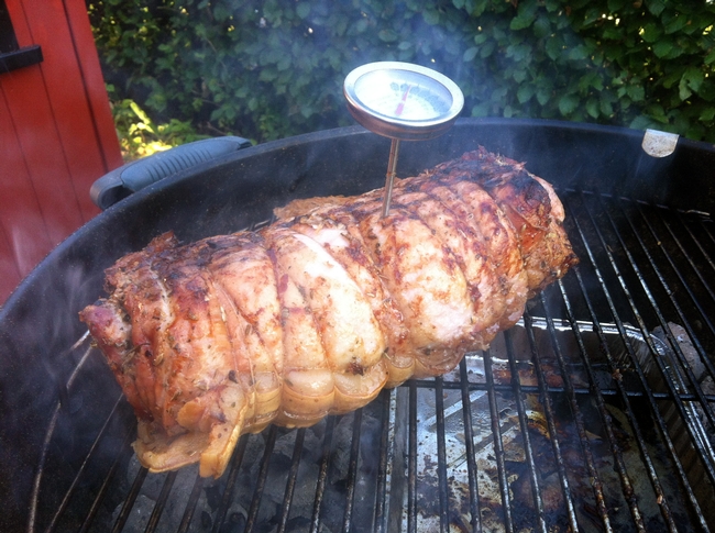
- Cook: Cook foods to the right temperature; be sure to check internal temperature by using a food thermometer.
- Chill: Chill raw and prepared foods promptly.
Here are some additional tips from the USDA. Be sure to check out the CDC's comprehensive food safety website, which also has materials in both Spanish and English. For food safety tips in real time, follow USDA Food Safety on Twitter.
Summer also means more outside grilling, which can pose unique food safety concerns. Before firing up the barbecue, check out these five easy tips from UC Davis.
Handling food safety on the road
Before you take off on a road trip, camping adventure or boating excursion, don't forget to consider food safety. You'll need to plan ahead and invest in a good cooler.
Remember, warns the USDA, don't let food sit out for more than one hour in temperatures above 90 degrees F. And discard any food left out more than two hours; after only one hour in temperatures above 90 degrees F.
If there are any doubts about how long the food was out, it is best to throw it out!
Get more food safety tips for traveling from the USDA.
Avoid heat illness
“Summer can be a time for fun and relaxation, but in warm climates, we need to stay aware of the signs of heat illness and help keep our family members and co-workers safe,” says Brian Oatman, director of Risk & Safety Services at UC ANR.
“UC ANR provides comprehensive resources on our website, but it's designed around California requirements for workplace safety.” But, Oatman notes, much of the information applies.
“The training and basic guidance – drink water, take a rest when you are feeling any symptoms and having a shaded area available – are useful for anyone at any time.”
To increase your awareness of heat illness symptoms – and to learn more about prevention – Oatman suggests a few resources.
“Our Heat Illness Prevention page has many resources, including links for training, heat illness prevention plans, and links to other sites. One of the external sites for heat illness that I recommend is the Cal/OSHA site, which spells out the basic requirements for heat illness prevention in the workplace. It's also available in Spanish."
For those on the go, Oatman also recommends the National Institute for Occupational Safety and Health (NIOSH) mobile heat safety app.
Dirt at Your Finger Tips - in the Field
WASHINGTON, June 26, 2019 – USDA's Natural Resources Conservation Service (NRCS) and the University of California at Davis Soil Resource Laboratory today announced the release of the iOS and Android SoilWeb app, version 2.0. The app now has a cleaner and more modern interface with GPS-location-based links to access detailed digital soil survey data (SSURGO) published by the NRCS for most of the United States. The newly updated SoilWeb smartphone application is available as a free download on Google Play  and Apple App Store
  .
.
“SoilWeb reached a new milestone this year when it was integrated with Google Maps and designed to scale across any device, desktop, tablet or smart phone,” said NRCS Chief Matthew Lohr. “SoilWeb app is a portable interface to authoritative digital soil survey data from NRCS, giving users access to practical detailed scientific soil information on the go.”
The SoilWeb app provides users with information relating to soil types that are associated with their location. The images are then linked to information about the different types of soil profiles, soil taxonomy, land classification, hydraulic and erosion ratings and soil suitability ratings. Identifying soil types is important to understanding land for agricultural production purposes and determining flooding frequencies and suitable locations for roads or septic tanks. SoilWeb provides gardeners, landscapers and realtors with information relating to soil types and how to optimally use the soil. Although soil survey information can be used for general farm, local, and wider area planning, a professional onsite evaluation may be needed to supplement this information in some cases.
“SoilWeb is a great way to understand the landscape you live in,” said Anthony O'Geen, UC Davis Professor and Cooperative Extension Specialist in the Department of Land, Air and Water Resources. “Producing food, constructing structures and maintaining landscapes all depend on this little understood, but critical outermost layer of the earth's crust, the soil.”
The app gives access to valuable scientific data through modern technology. All the soil information in SoilWeb was collected from the National Cooperative Soil Survey, organized by the NRCS, and accesses soil survey information the agency has been collecting since the 1890s. The resulting database, the largest such in the world, makes it possible for soil scientists to generate specialized maps using computer-aided techniques.
O'Geen developed SoilWeb with NRCS Soil Scientist Dylan Beaudette, in 2010 when Beaudette was a Ph.D. student at UC Davis. The app was a popular download, but by 2017 was no longer in compliance with requirements set by Apple and Google. Frequent users of SoilWeb had to rely on the web-based version from 2017 to June 2019. Any users with the older version on their phone can do a simple update to access the newest version. The app is a product of a 14-year partnership between NRCS and UC Davis College of Land, Air and Water Resources.
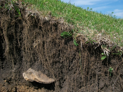
soil layers
Read About Your Soil
Here is a really good introduction to the use of the on-line Soil Survey from USDA. Maybe it is easier to follow than blogs I have posted in the past.
WASHINGTON — “Soil don't get no respect,” Rodney Dangerfield might have said (but didn't). Perhaps you know your state bird or flower, but do you know your state soil?
Well, in recent years soil has begun to get more respect. Since the celebration of the Soil Survey Centennial back in 1999, each state has been given its own official state soil. It was in 1899 that the U. S. Department of Agriculture started its survey of all the soils in the country.
SOILS COME IN MANY ‘Flavours'
You might wonder what a “soil survey” really is. Isn't it all just dirt — some perhaps stickier, or redder or deeper — that lies beneath forest, meadow, farm, home and garden?
There you go again. Not enough respect.
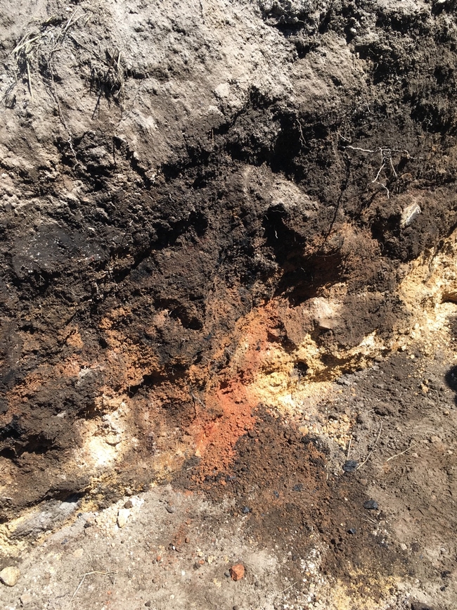
In fact, soils are distinctive, as different from each other as robins are from blue jays. These differences are hard to appreciate, of course, because soil is mostly underground, hidden from view. But if you were to dig some holes a few feet deep and then look carefully at their inside surfaces, you would find that soils are made up of layers of varying thickness, called horizons. One soil might differ from the next not only in the thickness of its horizons, but also in their appearance and feel.
Horizons might be as white as chalk, as red as rust, or as dark brown as chocolate. A horizon might be cement-hard, gritty with sand, or stuff for sculpture. And if you were to tease the dirt along one edge of the hole so it falls away naturally — wow! — each horizon would reveal its particles clumped together in arrangements like plates, blocks or prisms. Such information, and more, has allowed soils to be classified, much as birds, flowers and other living things are.
CLASSIFYING SOILS
Modern soil classification goes back only a few decades, when all the world's soils were grouped taxonomically into a dozen “orders.” Differences among orders reflect the formative influence of a particular combination of climate, plants and animals, topography, time and original rock material.
Just as all vertebrate animals are huddled together by biologists into smaller groupings (mammals, say) and those groupings into still smaller ones, so each soil order is divided and subdivided to include more distinctly different soils. At the end of the dividing and subdividing, you end up with a “soil series” identified with a proper name — like the Haven series in my vegetable garden, for example.
YOUR STATE'S AND BACKYARD'S SOIL
A particular soil becomes an official state soil by being widespread within the state; being distinctive chemically or physically; having some degree of name recognition; and, of course, getting a legislative stamp of approval. Examples include soils like West Virginia's Monongahela soil, Texas' Houston Black soil, California's San Joaquin soil and New York's Honeoye soil.
The job, now, of these “ambassadors” of the benevolent underworld is to rekindle awareness of soil's value as a natural resource that can only be renewed very slowly. Soil provides food, shelter, clothing and more, yet it is being lost at alarming rates to everything from blacktop to erosion.
Out in the garden this spring, dig a hole deep and wide enough that you can see and appreciate at least some of the various and distinctive horizons.
Then, if you want the name and a detailed description of that soil — or any soil — look at the maps and descriptions in the Soil Survey Reports issued by the U. S. Department of Agriculture, Natural Resource Conservation Service (NRCS). Search online for “soil survey nrcs” and you'll find links to soil maps for counties throughout the U.S. Or go to the link to “web soil survey.” At this site, you can type in a street address around which you “draw” your area of interest (AOI). The site will delineate the names and descriptions of soils within that AOI.
And of course this is available as an app at:
https://casoilresource.lawr.ucdavis.edu/soilweb-apps/
Online:
www.leereich.com/blog
leereich.com
http://www.leereich.com/2016/06/edens-gardens.html
soil weathered from rock

